
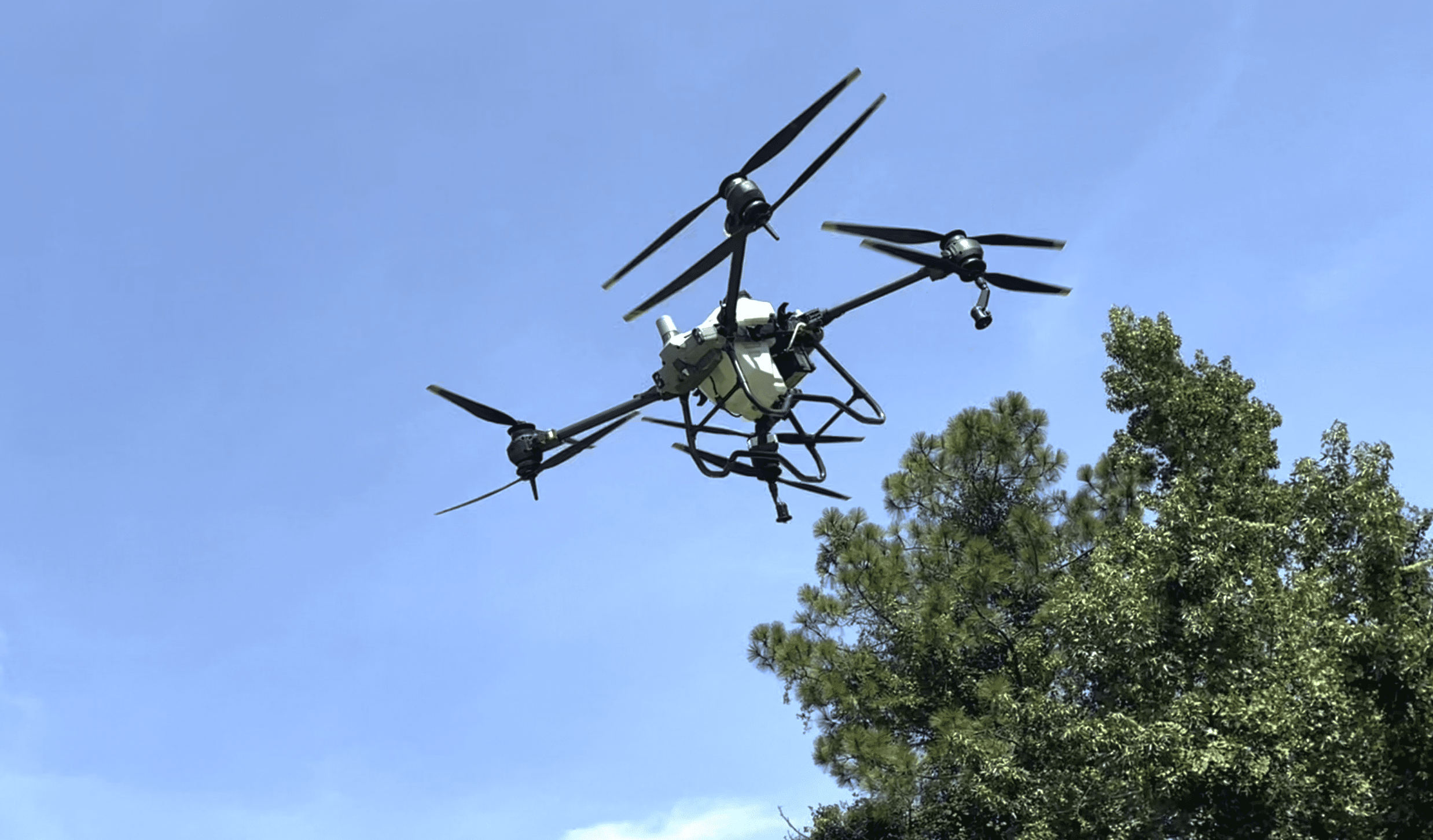
Just like any other piece of technology, adding a drone to your landscape company’s tools is an investment. If you’re not sure what purposes they could serve in your operations, check out how these landscape businesses have used drones to take their efficiency and accuracy to new heights.
Marketing
The main reason many landscape companies end up utilizing drones is for marketing purposes. Tyler Clark, a designer with The Green Scene Landscaping and Swimming Pools, based in Chatsworth, California, says they have been using drones for at least 10 years now and primarily focus on using them to collect post-production images and videos from finished projects.
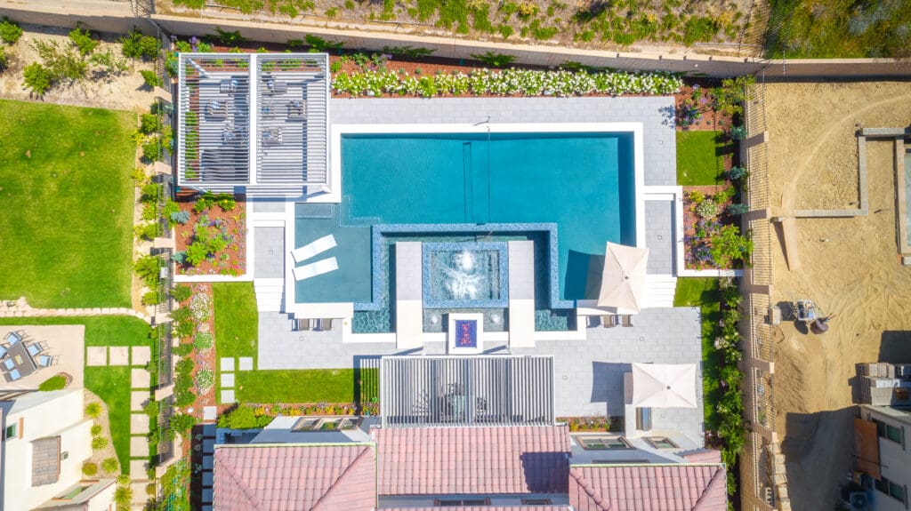
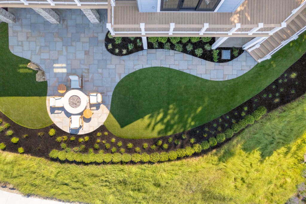
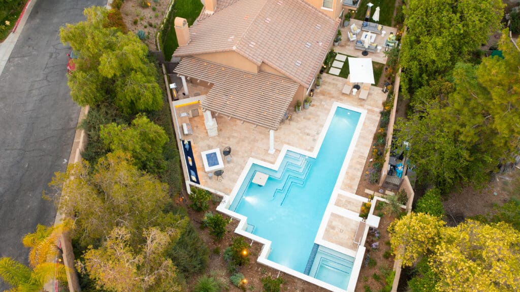
Drones are able to capture unique views of projects and can generate buzz with dynamic before and after shots.
Richard Schipul, owner of Designing Eden LLC, based in New Milford, Connecticut, says he bought his drone four years ago for marketing purposes but has also found ways to utilize it in landscape design.
“Our past projects definitely help sell future projects and there are some drone photos on our website,” Schipul says.
Kevin Turk, a designer with Ground Works Land Design, based in Cleveland, Ohio, says on their website they have a video of their design process, which includes their drone usage and it helps clients understand how they’re utilizing technology to improve their processes.
Site Mapping
Companies using drones have found their true value in flying them at the beginning of projects for aerial imagery and site analysis. Tim Lake, president of T. Lake Environmental Design, based in Dublin, Georgia, says they got their drone in 2018 to help provide them with weekly topographic maps needed for a landfill job. He says they rarely use traditional measuring tools any more, thanks to their drone.
Clark and Turk both say drones help them with their site mapping as well.
“The drone has become a big part of one of our first steps in the design process called site analysis, so that’s after the salesperson does that initial meeting with the homeowner,” Turk says.
Turk, along with another team member, will go to the site and shoot elevation pictures. In the past, they would use aerial images from the GIS website.
“We do a lot of new work on a lot of new builds, so obviously, the homes aren’t up with those images or if someone added a new patio, it’s not on the GIS website,” Turk says. “The drone’s main purpose is we put that up and shoot up-to-date aerial photography of that site, so we have an accurate design to go along with it.”
Turk will upload a drone image onto the Smart Level app to get live readings on elevations on the site.
“We’re just trying to maximize productivity and efficiency with the drone,” Turk says. “I can do all this on-site, rather than maybe taking a picture, going back to the office, uploading that picture to this program. I can do it all from my phone while I’m there. I need to make one site visit.”
Turk says the drone has saved them hours by eliminating inaccuracies like a patio not lining up properly with a GIS image.
“The drone allows us to really dial it in as far as the accuracy goes, and avoid having those issues down the road,” Turk says.
Schipul says in one instance, he was able to create a base plan for a site with a steep slope where a survey didn’t exist. He simply took a picture with the drone, used the deck length to set the scale and brought it into their design program Dynascape to trace the elements for the base plan.
Turk says when he’s flying the drone, he’ll also review the accessibility of the site and look for key features like the gas meter. Lake says the drone is particularly useful for mapping new residential properties as they don’t have to walk around and use tape measures on windows. They use a software called Drone Deploy and another called Pixar 3D that allows them to automate the flight.
“You hit a button; it’s pre-mapped,” Lake says. “It goes up to the preprogrammed altitude. It flies everything. It also can do a bit of a perimeter flight, so that whatever’s in the middle, it goes around it at a low angle and shoots that. So we can get windows, we can get everything, doors, walkways.”
Aside from just capturing aerial imagery, drones are capable of creating 2D maps and 3D models of properties, evaluating plant health with multi-spectral and thermal sensors, or mapping complex terrain and tree canopies with LIDAR.
All these companies using drones agree the imagery is far clearer and up-to-date compared to those available with Google Earth.
“The quality of the photo a drone will produce doesn’t compare,” Schipul says. “The photo quality is great, so you’re able to zoom into a photo and keep clarity at a much higher zoom than you can with Google Earth. I’d also say you’re in control of the photo location, so you’re able to capture the information you need.”
Project Tracking
Lake and Turk both use their drones for project tracking as well.
Turk has found it helps them double-check the dimensions of the installation and make sure they match the design.
“Our concrete guy will call me and say, ‘Hey, we have this patio formed up. Can you come drone it and check it out to see how accurate it is to the drawing?’” Turk says. “Let’s just say the radius is off by five feet it’s still a lot of square footage that is not accounted for.”
He says this is particularly useful when installing patios with those natural curves to them. He says his drone provides a bird’s eye view that confirms if the radiuses are off or not.
Operational Considerations
One major question with it comes to drone work is whether you want to operate one in-house or outsource.
Lake says it made more sense for them to own the drone for the landfill job versus subcontracting someone because they had to be on-site constantly.
“If you’re doing a $2,000 job, you don’t want to go buy a drone because it wouldn’t pay for the drone very well,” Lake says. “It made financial sense and logistical sense for us.”
However, eventually, Lake decided to find a fixed-wing aircraft pilot who had completed his airman’s certificate and then have him add the UAV license.
“It’s a great way to get your drone working quickly while helping a young person who is capable and needs extra cash,” Lake says.
Lake suggests sticking with subcontracting a local drone pilot until you have a consistent need. Clark says they are opting to subcontract their drone work for the foreseeable future. Meanwhile, Schipul and his son operate their drone.
“As a person who has never really played video games, I was apprehensive in flying it initially but the learning curve is short,” Schipul says.
Turk says he is the only person on staff who flies their drone regularly, as he represents the design team and has a background in landscape architecture. He says when he joined the team, he noticed an older model drone sitting in the closet and expressed interest in finding ways to utilize it in the field.
Advice for Others
If you’re company needs a bird’s eye view for large properties, drones can help increase your overall accuracy. Turk says their artificial turf company utilizes the drone as well.
“Like most technology, it’s a tool, not a magic wand,” Lake says. “It will not help if you cannot leverage the output. In my opinion, it is most useful to a true design-build firm that has landscape architects on staff who can both fly the drone and competently use the data it provides. It is also very helpful for quantifying large maintenance sites that are too new to show up on NearMap, Site Recon, or GoiLawn. We are building so rapidly in Georgia that many of our large sites are not yet satellite mapped.”
Schipul notes you do need to be aware of restrictions with unauthorized air spaces near airports or government buildings.
“There are gray areas in the licensing of the drone,” Schipul says. “You have to register drones differently if you are using it for commercial purposes. After reading the different licenses, I took the commercial license as someone who is getting paid to use the drone. I’m not charging someone to use my drone, but I’m using it to make my life easier during the design process, so I registered as a non-business license.”
Turk encourages other companies to invest in drones and have employees who are FAA-certified to fly them.
“It’s an investment,” Turk says. “They’re not cheap, and you need to know how to use it the right way. Traditionally, they are just used to take pictures for social media marketing, but finding those ways to improve our processes through landscape design is huge.”