
If you’re on the fence about investing in drone technology, you may be limiting the possible ways that this tool can be used for your landscape company, especially if you choose to have one in-house.
While most operations tend to use drones for marketing purposes, so they can capture aerial photos and videos of their projects, T. Lake, based in East Dublin, Georgia, approached the usage of their drone from an engineering and efficiency need.
Tim Lake, president of T. Lake, says their usage of the drone became a core operational tool from day one.
In 2018, they were doing a large earthwork project and needed to validate their progress, compliance with the design and soil volumes. Lake says they were spending anywhere from $1,200 to $2,000 on a weekly basis to bring in a surveyor to shoot grades, and then they had to wait a week to 10 days for the results.
“I had been watching the drone technology advance for construction and knew we could use it to do topo and volume calculations,” Lake says. “It was a no-brainer. $1,400 (back then) plus $3,000 for an annual software subscription, same-day turnaround for data, high safety gain and exponential cost savings on the project.”
Lake notes that drones for this today run around $12,000 to $16,000. He says if he were starting over with this technology, there’s not a thing they would have done differently.
“We embraced drones for a specific purpose and initially for a specific project, saving over $20,000 in survey fees,” Lake says. “It was a direct job cost that became a benefit to us in many other ways later.”
Site Surveying
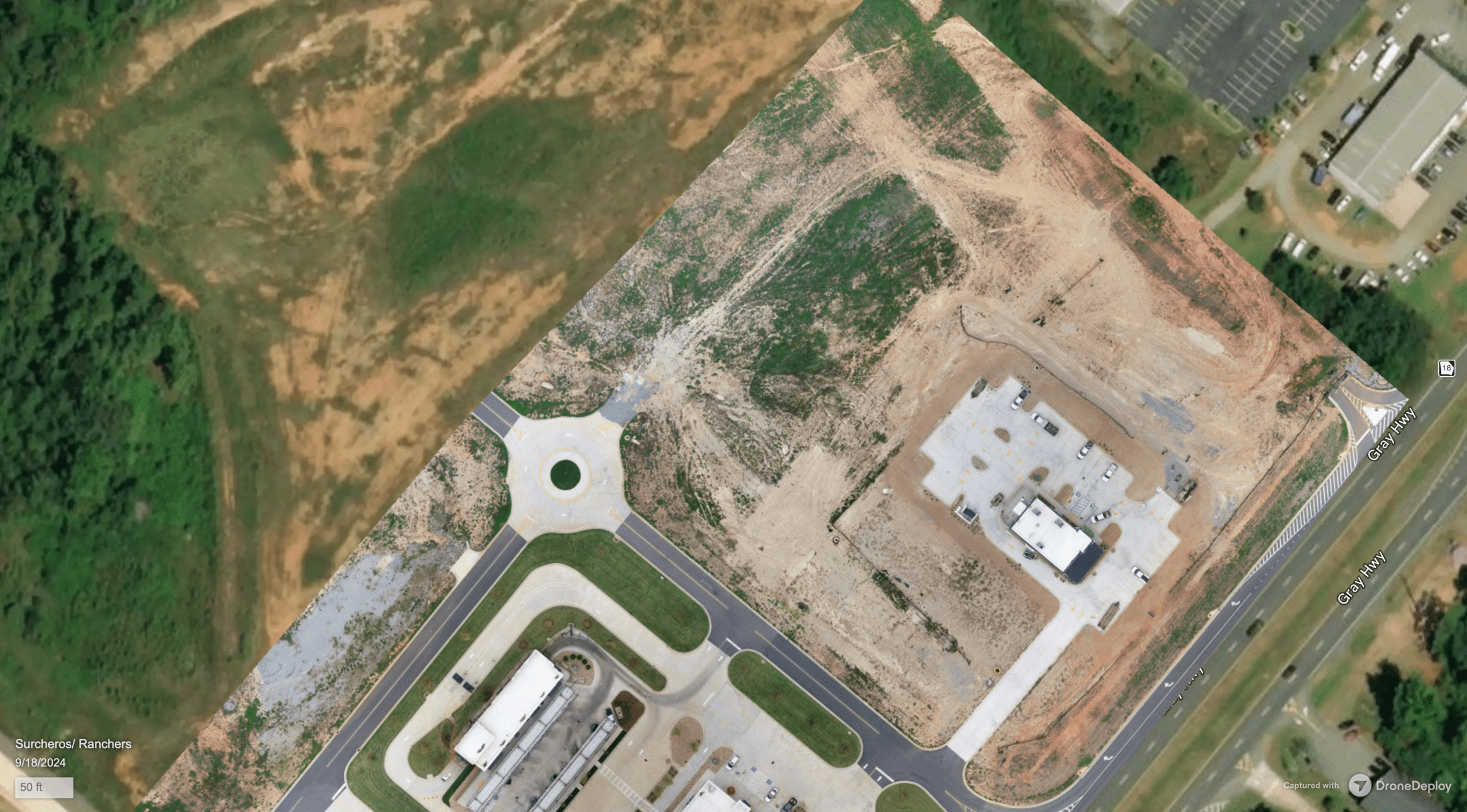
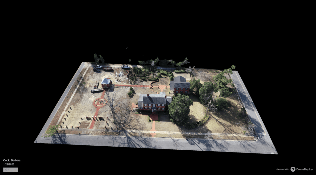
One of the main practical uses T. Lake makes of their drones is site surveying. On the construction side of the business, they can create base maps and topographical generation for site analysis and documentation.
Their maintenance division also uses the drone for site measurements when NearMap doesn’t have current imagery. Lake says occasionally they’ll load this into SiteRecon or PropertyIntel to measure.
He says the drone has helped speed up their estimating process immensely as they don’t have to pull tape or use rolling wheels to collect measurements or be in the field to locate trees and other site elements.
He says it’s hard to calculate an exact amount of time saved due to the variable scale of projects.
“It does always save hours, particularly on the front-end tasks of measurement and base map development,” Lake says. “It never adds time.”
Process Mapping
For larger projects, Lake says they will utilize the drone for process mapping when they need better detailed images than satellite photos can provide.
“The drones have helped with planning and sequencing, and communicating clearly to work teams and clients,” Lake says. “I think of it as advancing site intelligence.”
Progress Reporting
Another way T. Lake uses their drones is for progress reporting on construction and industrial sites. Lakes says this is a huge safety benefit as they don’t have to get close to machinery on the ground.
“Video inspections have been a great communication tool for us,” Lake says.
Subcontracting Versus In-House
One consideration you’ll have to decide on is whether you want to simply subcontract a drone pilot. Most subcontracting drone data collectors work with their own equipment, so if you aren’t ready to invest in owning a drone yourself, this can be a good way to test the waters.
Lake says they sub out their large-area spraying work to agricultural operators.
“If you decide to use drones for pesticide application, you need additional licenses just like a crop duster would, and also need a mobile launch platform with water tanks and a mixing station,” Lake says.
Choosing to operate a drone in-house doesn’t just include the cost of the drone itself. Lake says they also pay for software like Drone Deploy and Pix4D.
“You need to also consider the cost of pilot training and certification and discuss any impacts to your insurance with your agent,” Lake says.
He says that while the drone has not materially impacted their insurance costs, they did include coverage. Lake stresses that drones are serious tools that need to be assessed with care.
“It’s not a toy, and it carries a liability,” Lake says. “If you drop a drone on somebody’s head, through a car window, or into the engine of a jet that is landing or taking off, it could be fatal. With the potential to weaponize being so high, I expect, and hope that drones will be more tightly regulated and generally made unavailable to the public except for licensed, professional use.”
Lake notes that young landscape architects and engineers are ideal candidates to become your drone pilots because they are usually tech-savvy and are often charged with gathering basic information. He says young pilots who are working on their hours are another good option, as they already have their pilot’s license and will only need to add UAV training.
“To me, the decision matrix for investing in this is simple: If you do projects that require surveyors, daily or weekly progress reporting, and you have LAs or EITs/PEs on staff, you probably could benefit from having a drone,” Lake says. “If you just want cool videos and photos of your latest install, hire a local drone operator, and you stay focused on what drives revenue and margin.”