
Slowly, but surely technology is being integrated into the green industry and one interesting tool some landscape companies are exploring is drones.
While drones were originally used for military purposes, they have migrated to the civilian world and are used by everyone from hobbyists to businesses.
“As you dive into the drone industry at large, you’ll quickly discover it is huge and growing fast, and very exciting the range of possibilities it opens up!” says Graham Pellettieri, technology director and project manager for Pellettieri Associates, Inc., based in Warner, New Hampshire. “It has caused us to think very differently about the design process. We used to use a land surveyor to kick off our design process, but now sometimes we’re replacing (or augmenting) that survey with a drone capture of the property, and it has improved our deliverables to the clients and sped up our process.”
Benefits of Using Drones for Landscaping Jobs
Pellettieri says using drones helps provide a fresh perspective on the property as they allow you to see the property in a higher overall context.
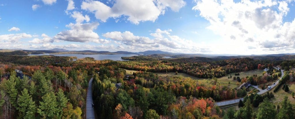
“We find capturing a bird’s eye view photo of the property gives you a very helpful reference for design planning – one that is more detailed and updated than say a Google maps image,” Pellettieri says.
He says this can help with documenting existing site conditions, determine relational aspects of one area of the property to other areas and provide a visual aid for design discussions.
“Customers are increasingly accustomed to having comprehensive visual data,” says Jeff Brooks, COO of Mapware. “If the customer has to imagine a space or view it on a 2D map, you’re really relying on their mental image to help close a deal or explain progress on a project. If they can just see it and click around for themselves, all the work of explaining, correcting (or worse, resetting) expectations goes away.”
Pellettieri says photo and video are only one aspect of drone use in the landscape.
“We’re diving even deeper by doing full-blown 2D detailed mapping with annotations, 3D photogrammetry modeling that provides topography and building information, and even capturing sensor-based drone data (such as thermal imaging) that can be used to assess things like plant health, solar exposure, and soil temperatures,” he says.
He says LIDAR (a method for determining ranges using a laser) is also gaining traction for detailed land surveying.
“The sky is the limit when it comes to drones!” Pellettieri says.
Drone Operation Requirements
While drones are a powerful tool for the design planning process, Pellettieri cautions drones do require substantial time, money and interest to launch them successfully.
“We first started the process two years ago, have worked diligently to launch our drone operations, and we’re still experimenting with different types of data, file formats, and refining and honing our process internally today,” he says. “So, it’s not like buying a new leaf blower that employees will be able to use on day one. It’s more like incorporating a crane or specialty piece of equipment into your operations – you need the right equipment and people who are trained and authorized to operate it safely.”
Currently, the minimum requirements to operate a drone for your business includes:
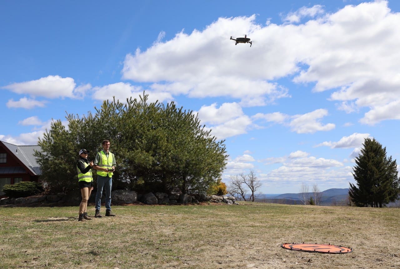
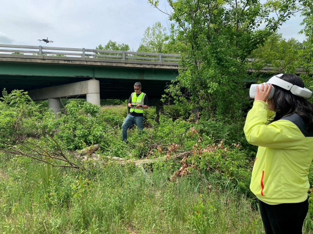
- Earning your Part 107 certification for the Pilot in Command and a second person who acts as a Visual Observer (spotter).
- Registering your drone with the Federal Aviation Administration (FAA).
- Having an insurance policy to cover the aircraft and your operations on a client’s property.
However, because regulations are constantly evolving, it’s best to do your research on this by starting at the FAA’s website. This agency has up-to-date guidance on the licensing, operational requirements, and markings you’ll need to put on your aircraft.
In Pellettieri’s case, he is the company’s pilot. He studied for his Part 107 certification for a few months before taking the test. He encourages those planning to take the test to put in a fair amount of hours studying and to take practice tests.
“It’s harder and more extensive than most people would expect – you need to learn a lot about FAA rules and regulations, weather conditions, how to read sectional charts, and how to operate a UAV safely to name a few,” Pellettieri says. “I’ve seen folks think it will be easy to pass the test, go in to test with minimal studying, and not pass the first time. You also need to stay up to date on the ever-changing regulations and renew your certification every two years.”